|
How physical processes
influence drainage basin systems and landforms |
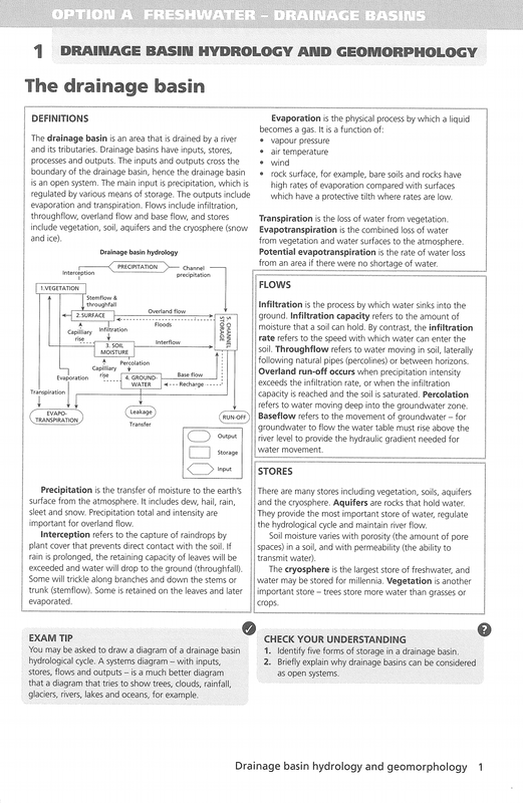
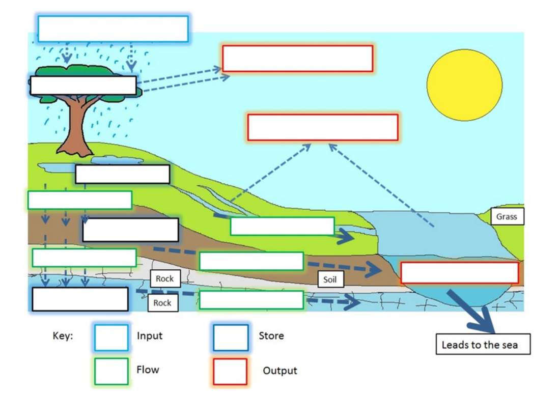
The drainage basin as an open system with inputs (precipitation of varying type and intensity), outputs (evaporation and transpiration), flows (infiltration, throughflow, overland flow and base flow) and stores (including vegetation, soil, aquifers and the cryosphere)
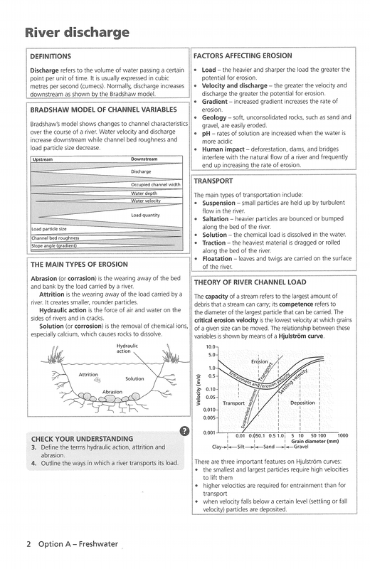
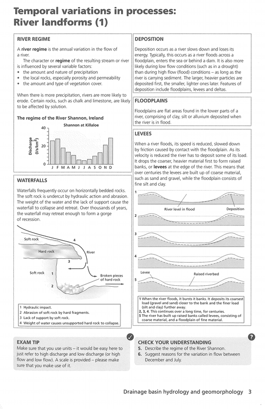
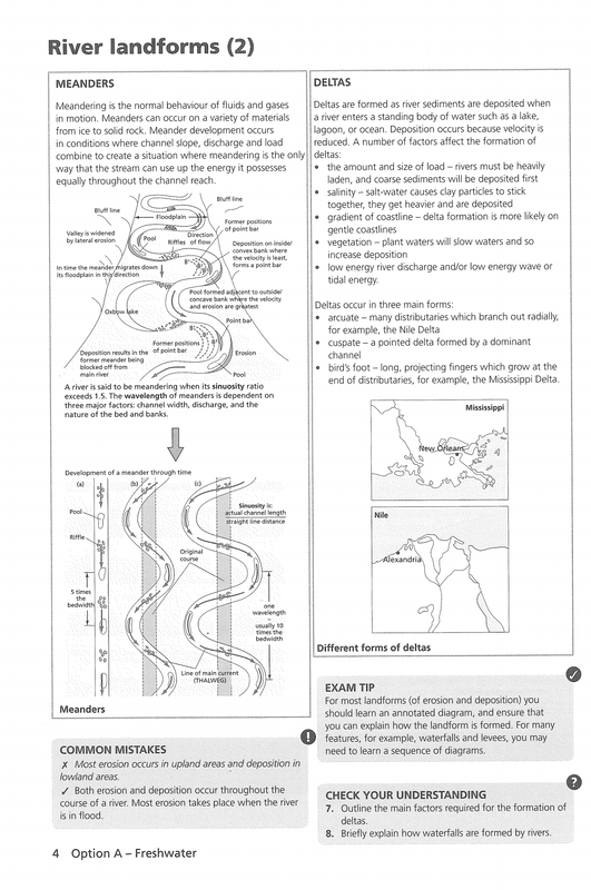
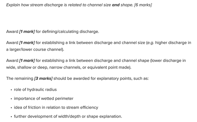
River discharge and its relationship to stream flow, channel characteristics and hydraulic radius River processes of erosion, transportation and deposition and spatial and temporal factors influencing their operation, including channel characteristics and seasonality The formation of typical river landforms, including waterfalls, floodplains, meanders, levees and deltas |
|
|
|
|
Extension, case studies and tasks
|
|
|
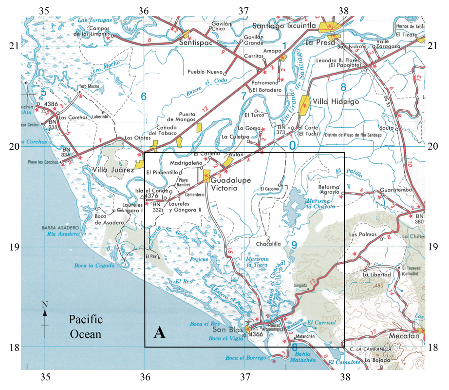
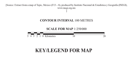
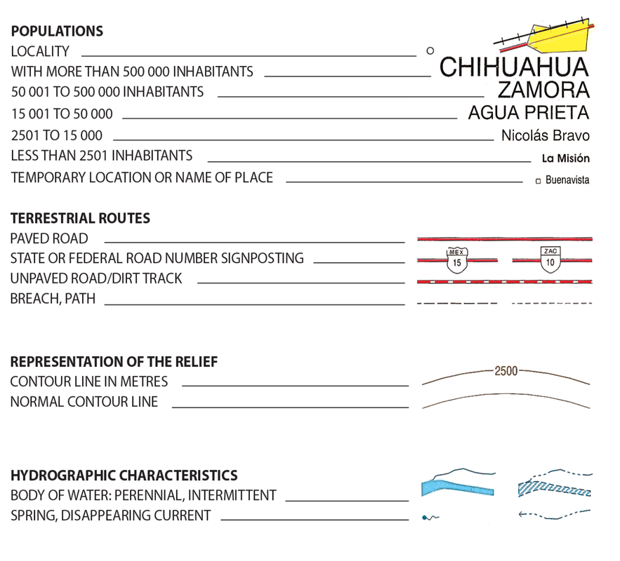
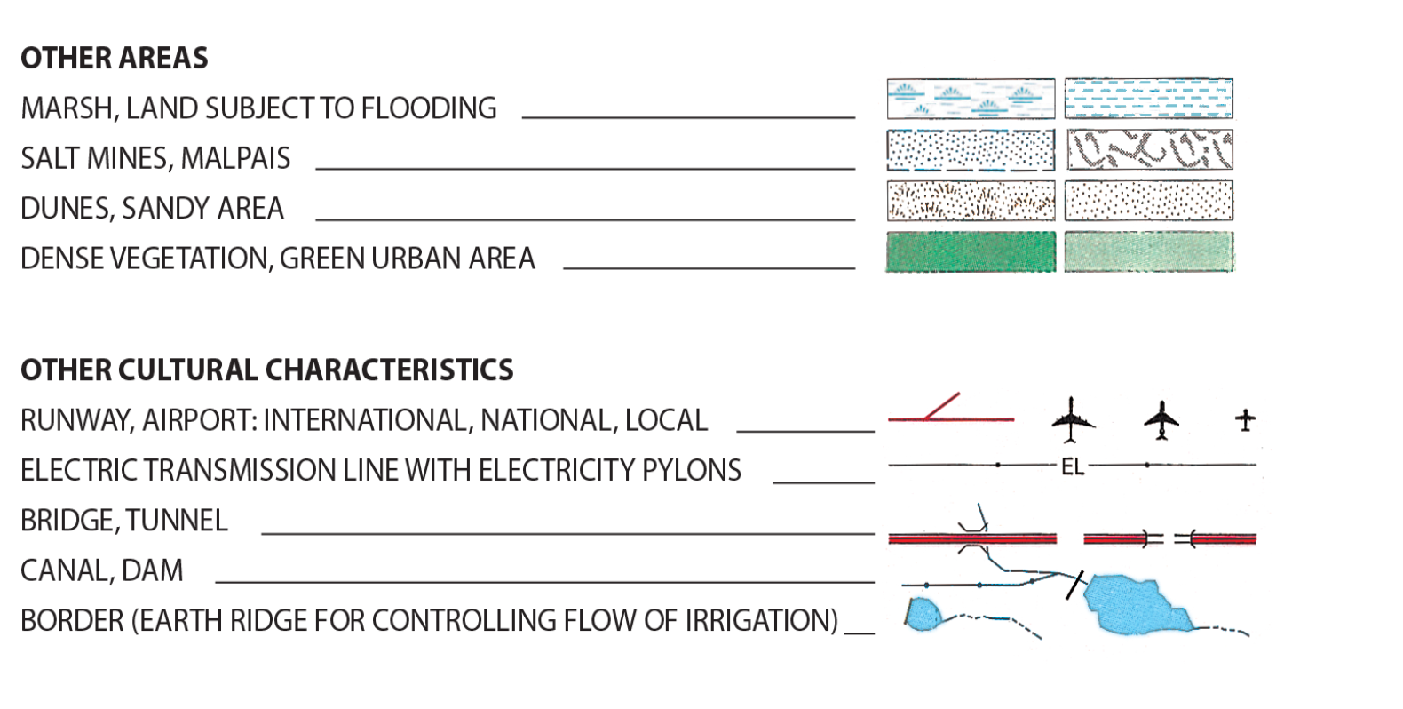
The map extract shows an area in western Mexico. The scale of the map is 1:250 000 and the contour interval is 100 metres.
|
|
a. Describe the geographical characteristics of the Río Grande de Santiago downstream from La Presa. [4]
b. Analyse how the freshwater resources shown in box A on the map could be used for different purposes. [6]
b. Analyse how the freshwater resources shown in box A on the map could be used for different purposes. [6]
