The use and outputs of technology to revolutionise Geography
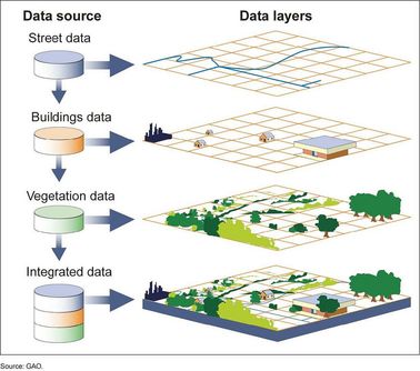
What are the range and types of capabilities for GIS (geographic information system) within the study of Geography? How have they changed our understanding of both the human and physical geographical processes that impact our societies? What are their limitations? GIS can be as simple as mapping the location and distribution of parks in a city and comparing this with population distributions to give an understanding of access and density of use.